TAS
MADE FOR ISRAELI SKIES

BLUE SKIES.
CLEAR BRIEFINGS.

TAS turns METAR, TAF and NOTAMs into pictures you read in a second, checks every Israeli runway against your crosswind limit, and keeps your Cessna, your currency and your checkride prep in one happy app.

Free · Herzliya, Ben Gurion, Haifa, Rosh Pina, Ramon and 21 more airfields · Live from IMS & NOAA

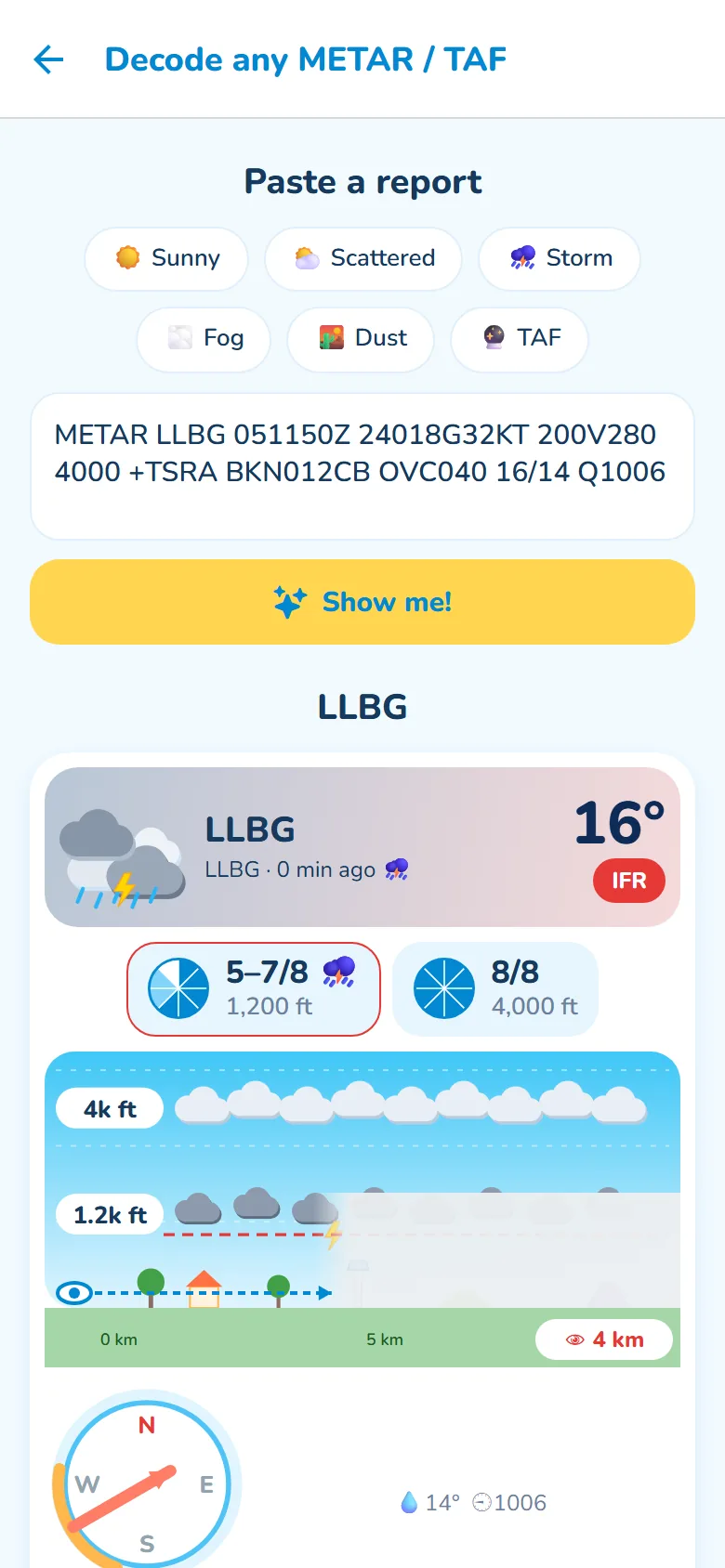
A thunderstorm METAR drawn as pictures: storm clouds, 5–7/8 and 8/8 cloud layers, 4 km visibility
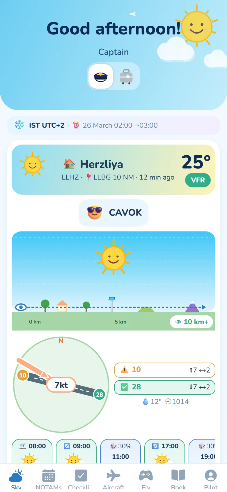
TAS home screen: Herzliya weather with sunshine, CAVOK, runway diagram with wind and TAF cards
LLHZ HERZLIYALLBG BEN GURIONLLHA HAIFALLIB ROSH PINALLER RAMONLLMG MEGIDDOLLES EIN SHEMERLLKS KIRYAT SHMONALLMZ BAR YEHUDALLEY EIN YAHAVLLOV OVDALLBS BEERSHEBA
WEATHER

WEATHER.
IN PICTURES.

Sun, clouds, rain and fog drawn from the real report. Cloud layers at their true height in eighths of the sky, visibility you can see across the landscape, and the wind landing right on the runway. Every time in Israel time, with a heads-up before the clocks change.

  • 8-slice okta circles
  • TAF timeline
  • Decode any METAR
  • IST / IDT aware
Decoded thunderstorm METAR with cloud layers and visibility scene
NOTAMS

NOTAMS.
ON A CALENDAR.

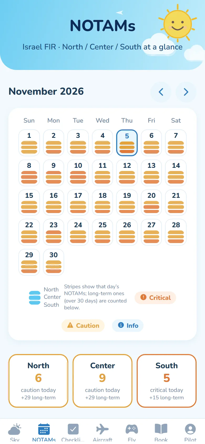
Every Israeli NOTAM translated into plain English and highlighted by what matters: runway and airspace closures, firing areas and GPS interference stand out at once. Every day is split into North, Center and South, so you see where the limitations are at a glance.

  • North · Center · South
  • Critical highlighted
  • iCal feed
NOTAM month calendar coloured by severity
RUNWAYS

EVERY RUNWAY.
CROSSWIND, CHECKED.

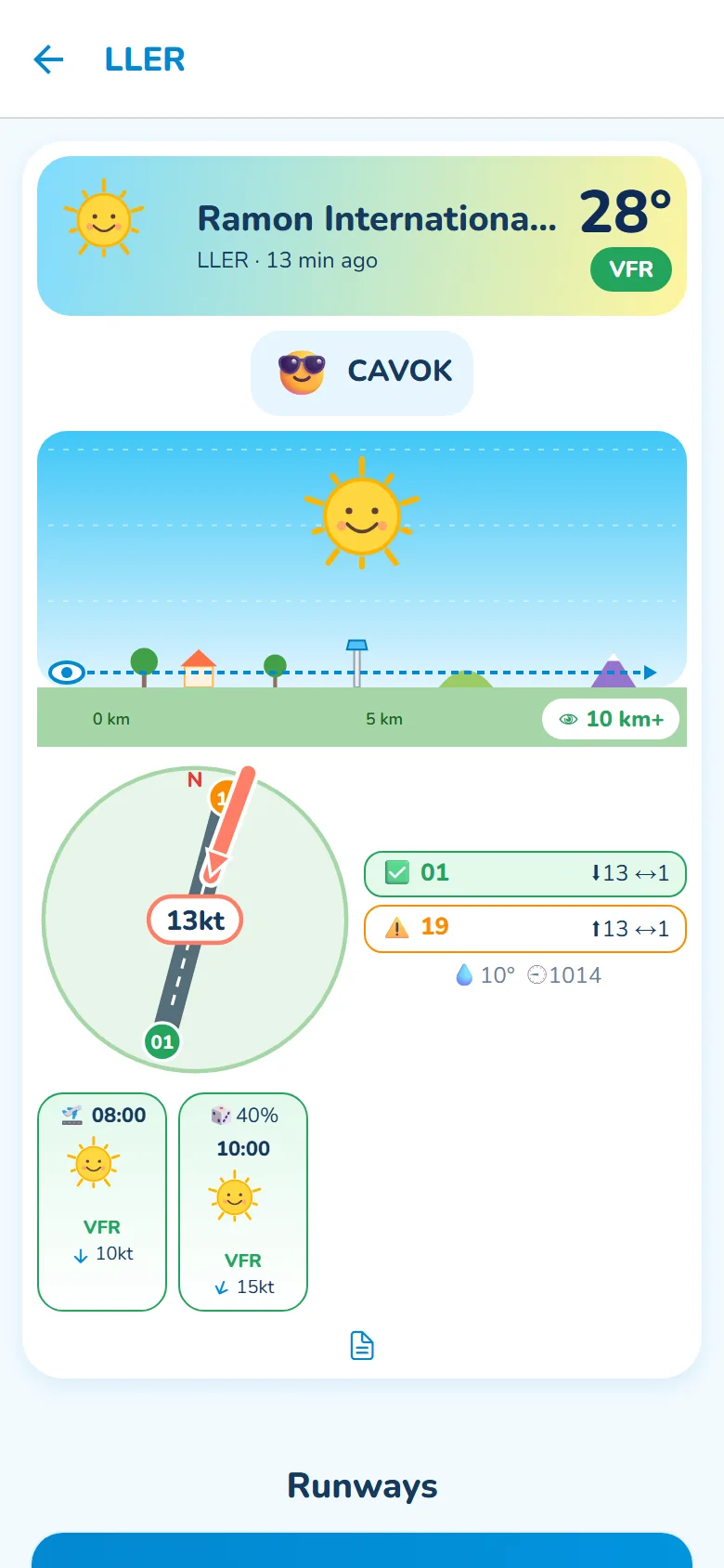
26 Israeli airfields with their runways drawn at true heading. The live wind arrow points at the runway, and each end shows go, tailwind, or over the C172’s 15-knot demonstrated crosswind, gusts included.

  • Head & crosswind per end
  • Nearest METAR for small strips
  • Local NOTAMs
Ramon airport: runway diagram with the wind arrow, runway 01 go and 19 tailwind
YOUR AIRCRAFT

YOUR CESSNA.
BY TAIL NUMBER.

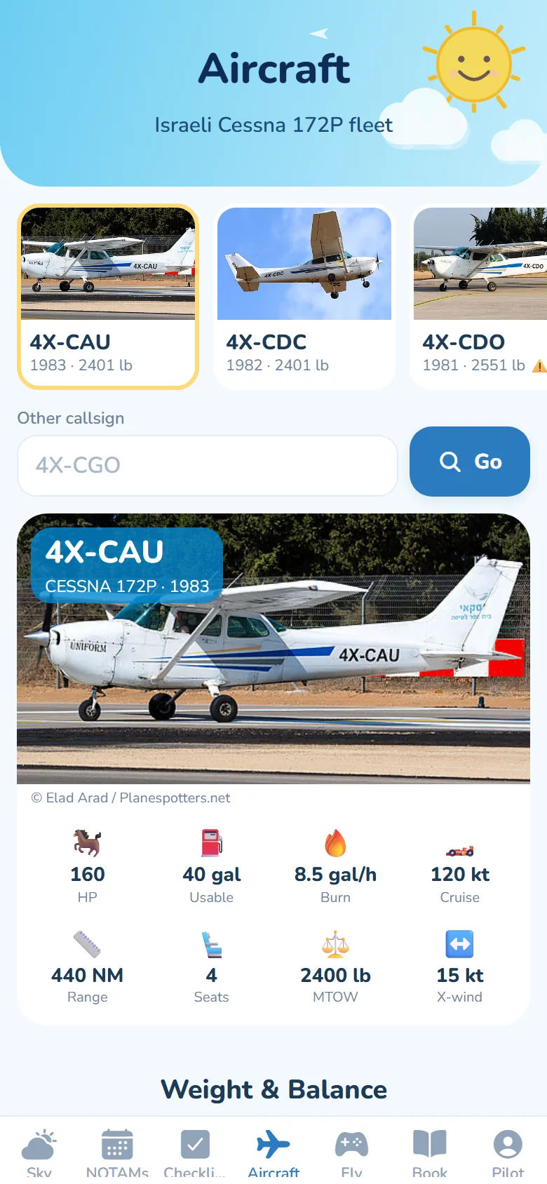
Pick any Israeli-registered Cessna 172P straight from the national register, with photos, POH specs and a weight-and-balance check drawn on the CG envelope. TAS even flags airframes whose registered weight differs from the book.

  • 4X- register lookup
  • CG envelope chart
  • Shared weighing data
Cessna 172P fleet gallery with photos and spec badges
CHECKLISTS

TAP. CHECK.
NEXT.

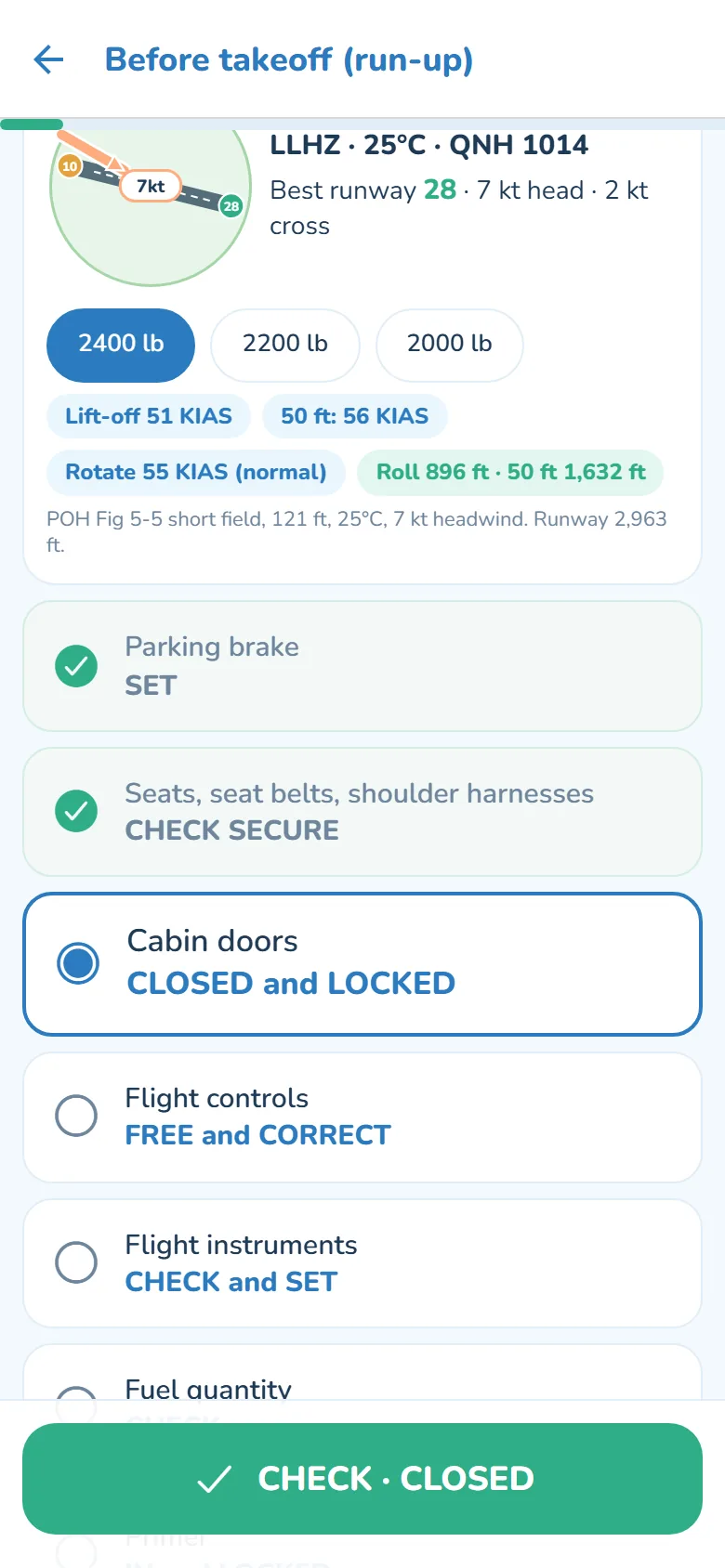
Every C172P normal and emergency checklist from the POH, one big tap per item and it moves to the next. Unlike a paper card, TAS shows today’s runway wind, your takeoff speeds and distances for your weight, glide distance in an emergency, and counts your landing straight into the logbook.

  • One-tap emergency
  • Memory items marked
  • Live runway & POH speeds
  • Screen stays awake
Before-takeoff checklist with live runway wind and POH takeoff speeds
CHECKRIDE PREP

CHECKRIDE SOON?
WE’VE GOT YOU.

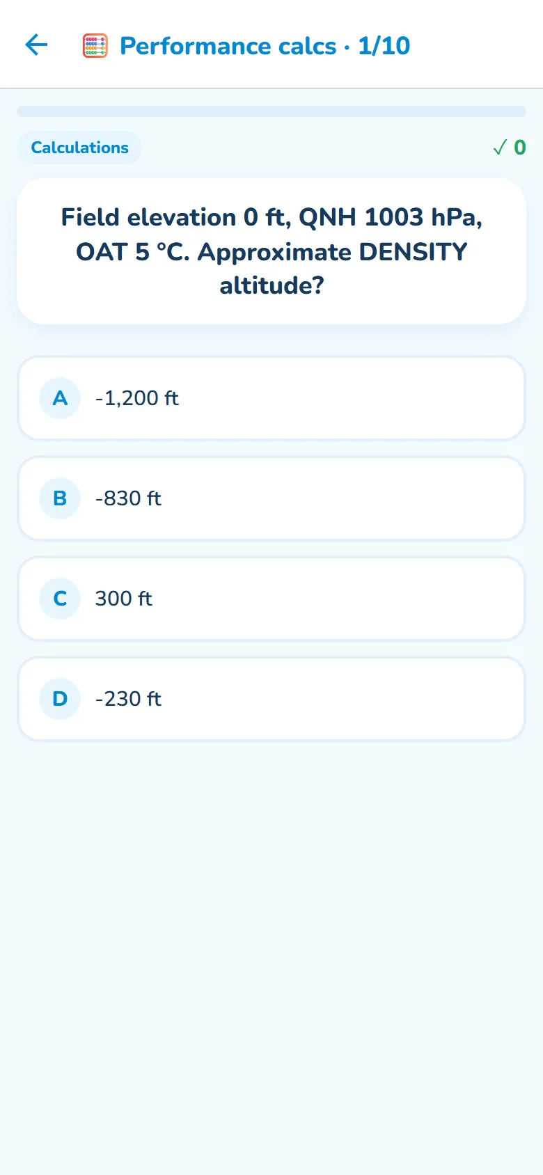
Over 100 questions from the POH, plus endless performance problems built from the real tables: takeoff and landing with wind and grass, climb, cruise, trip fuel, density altitude and CG. Shuffled every time, with the working shown step by step.

  • Pop quiz
  • Performance calcs
  • Checkride mock
  • 42 POH tables
Quiz question on density altitude with four answers
SIMULATOR

FLY IT
BEFORE YOU FLY IT.

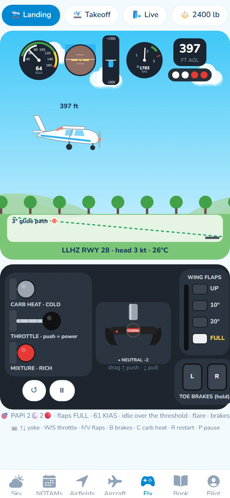
A light Cessna 172P simulator with a real-feel yoke, push-pull throttle, carb heat, flap lever and toe brakes, calibrated against the POH. Land on Herzliya’s runway 28 in today’s wind, follow the PAPI, then compare your ground roll with the book.

  • PAPI & glide path
  • 2400 / 2200 / 2000 lb
  • Live wind & gusts
Simulator on final approach with instruments, PAPI and Cessna cockpit controls

AND A FEW HAPPY EXTRAS.

Never fly expired

Flight review, medical, instrument check and English proficiency counted down, with reminders at 90, 30, 7 and 1 days.

Passenger mode

Taking someone up? One tap turns the briefing into sunshine, temperature and “great flying weather”.

Recency at a glance

Day, night and IFR currency from your logbook counts, so you know before you invite friends.

The handbook, readable

Limitations, speeds, performance and checklists as clean tables, with “how to calculate” lessons.

Built for Israel

IMS weather, Israeli NOTAMs, the 4X- register and Israel time with summer and winter changes.

Private by design

No ads, no trackers, no selling data. Export or delete your account in the app at any time.

FLIGHT SCHOOLS & CLUBS

ONE FLEET. EVERY PILOT READY.

Give your students and members the same weighing data, the same quizzes and the same reminders.

Add your fleet

Enter each tail’s official weighing data once; every pilot flying it sees the same numbers.

Students practise

Performance calculations, POH quizzes and simulator landings between lessons.

Everyone current

Medical, flight review and recency reminders keep the roster flight-ready.

Talk to us about your fleet

REFERENCE ONLY.
THE POH HAS THE LAST WORD.

TAS is a study and situational-awareness aid. It is not an approved flight manual, electronic flight bag or briefing service. Always fly with your aircraft’s approved POH/AFM and weight and balance report, an official weather briefing and current NOTAMs. You are pilot in command. Read the Terms of Use.

READY FOR BLUE SKIES?

Open TAS in your browser now. The iPhone and Android apps are on their way.